Mapping & Petrography Appendices · appendix-05
Structural Analysis — Sheet 05
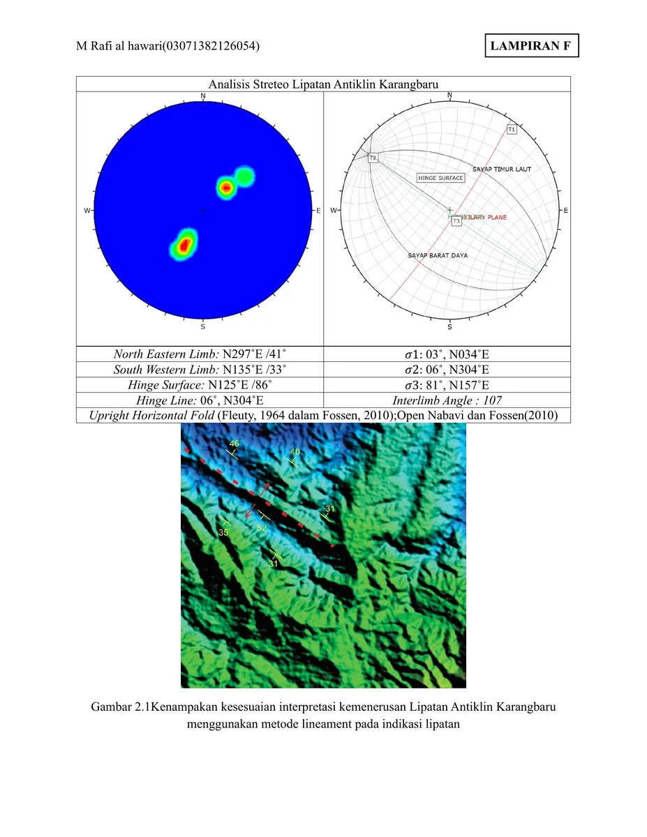
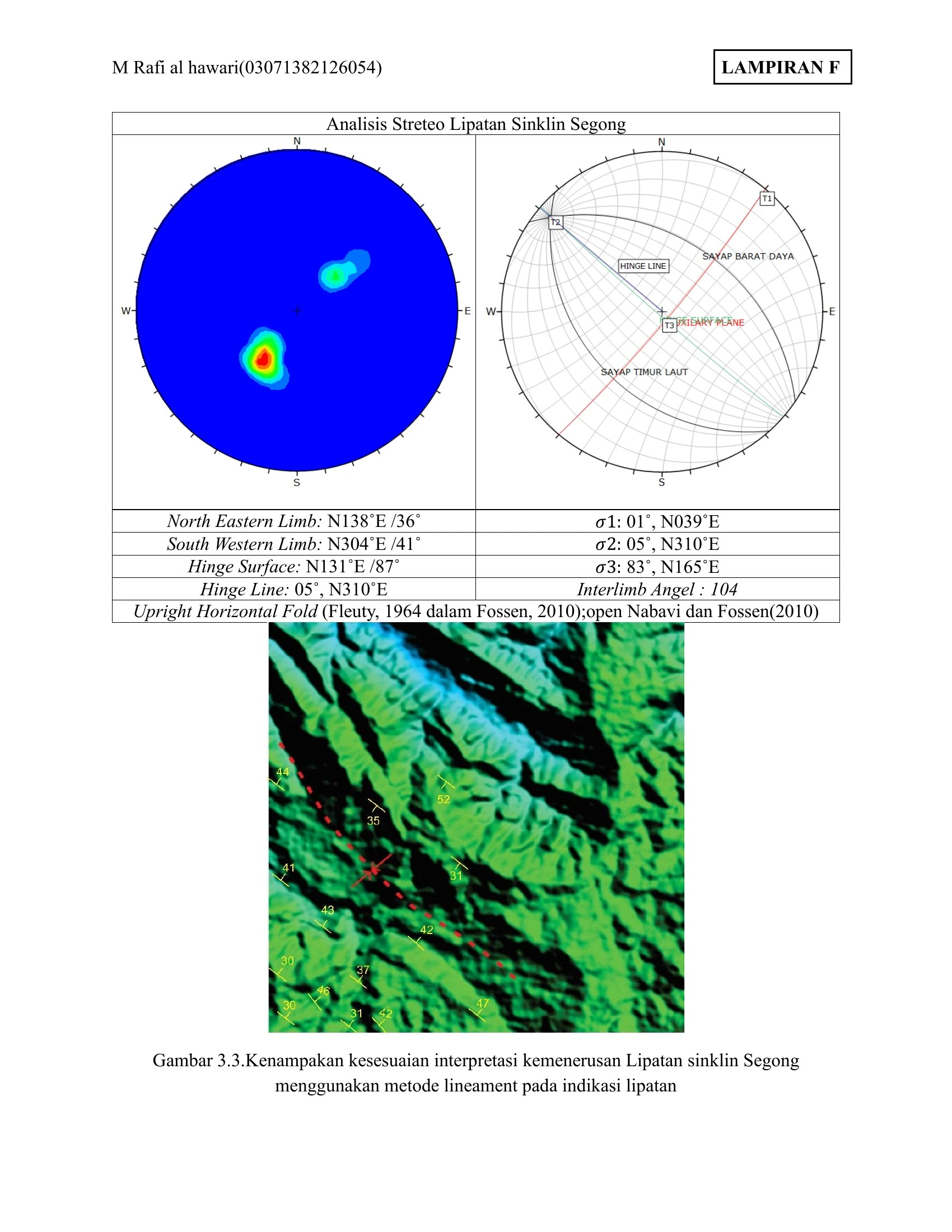
This plate couples a second fold-orientation dataset with terrain imagery, allowing the statistical solution to be checked against the mapped landscape.
SOURCE-LED TECHNICAL READING
Geological interpretation and evidential boundary
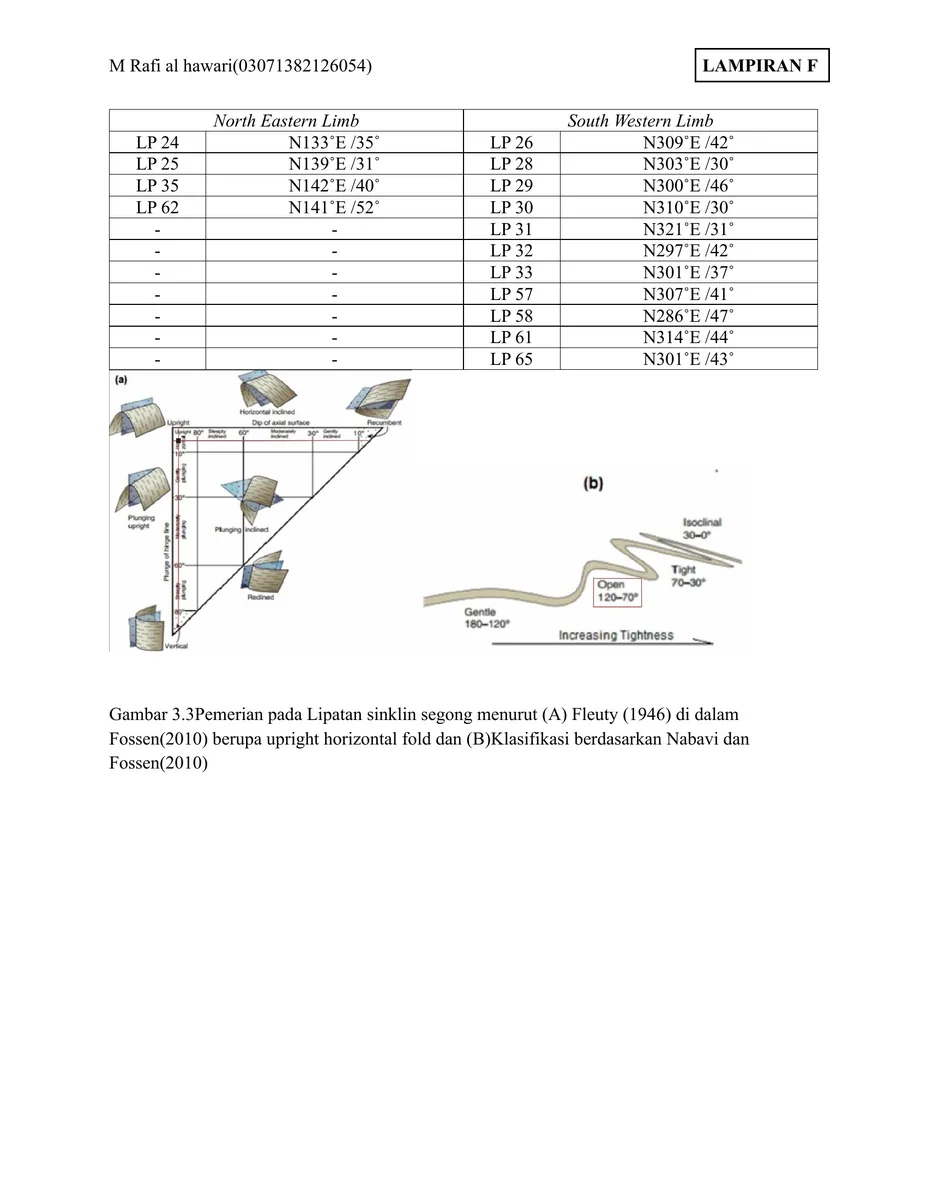
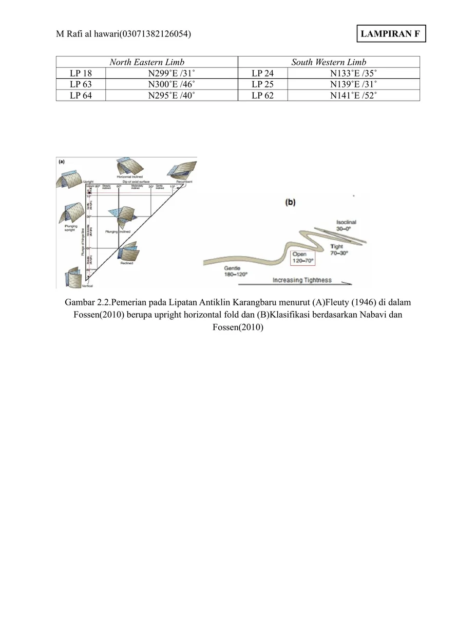
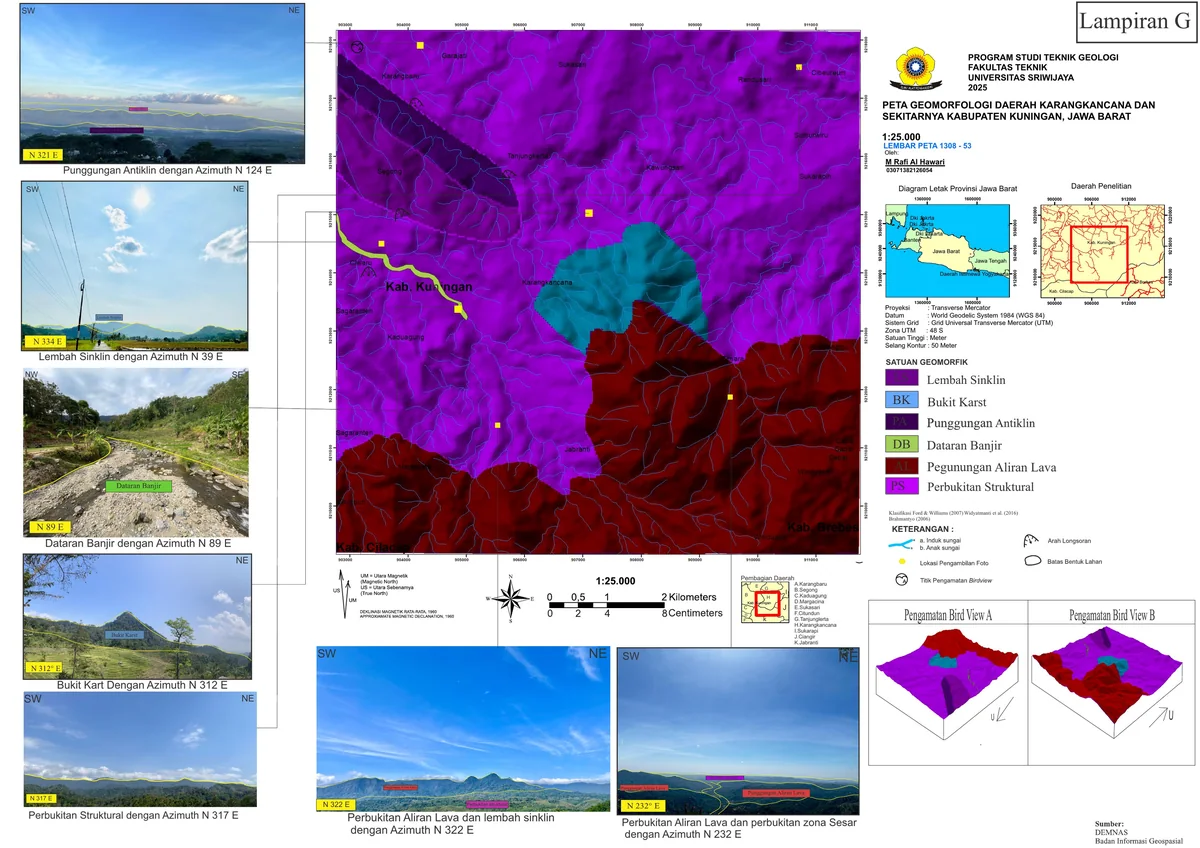
This plate couples a second fold-orientation dataset with terrain imagery, allowing the statistical solution to be checked against the mapped landscape. The comparison should remain directional rather than purely pictorial: calculate the angular difference between the fold axis, ridge or valley trend and map trace, then assess whether it lies within measurement and fitting uncertainty. Similar orientation does not prove causation because resistant beds can guide relief independently of hinge position. The strongest interpretation emerges when opposing limb dips, stratigraphic repetition, younging direction and the terrain expression all agree. Any discordance should be used diagnostically to test plunge variation, fault interference or an incorrectly assigned structural domain.
- Source
- Private geological appendix archive · controlled source record
- Location in source
- Source-linked record
- Image quality
- HD
- Record ID
- appendix-05