Mapping & Petrography Appendices · appendix-08
Final Geological Map — Sheet 08
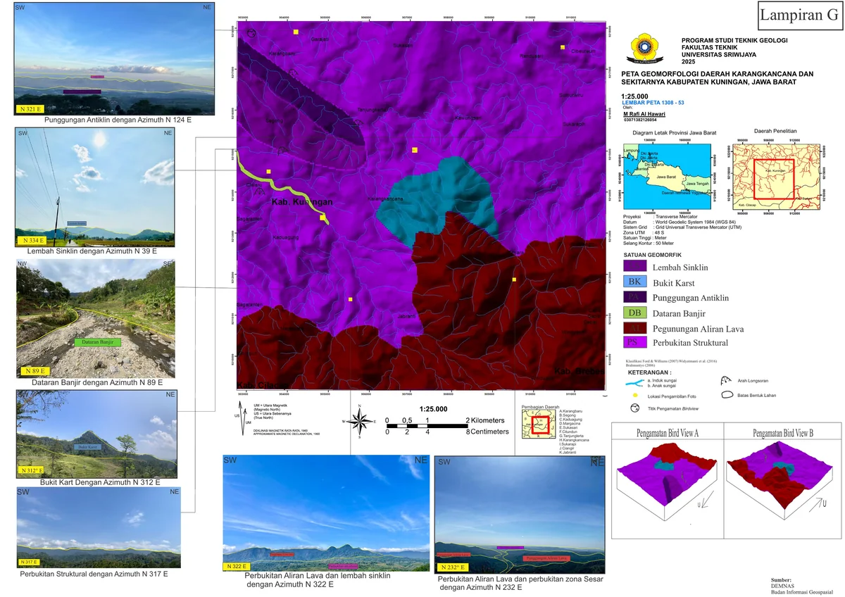
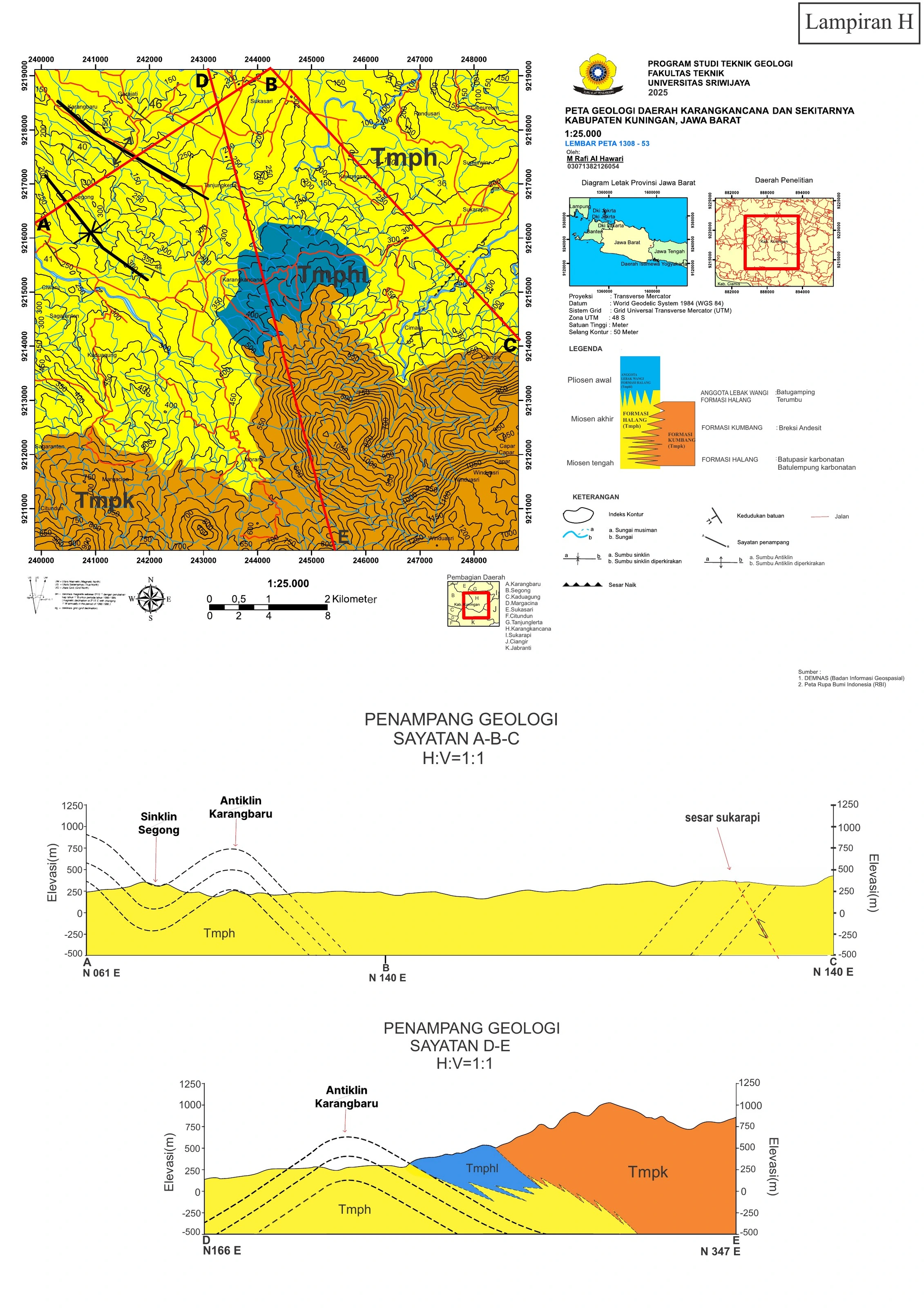
The final geological map and cross-sections are the highest-level synthesis of the survey, integrating 85 GPS-controlled stations across the 9 × 9 km area.
SOURCE-LED TECHNICAL READING
Geological interpretation and evidential boundary
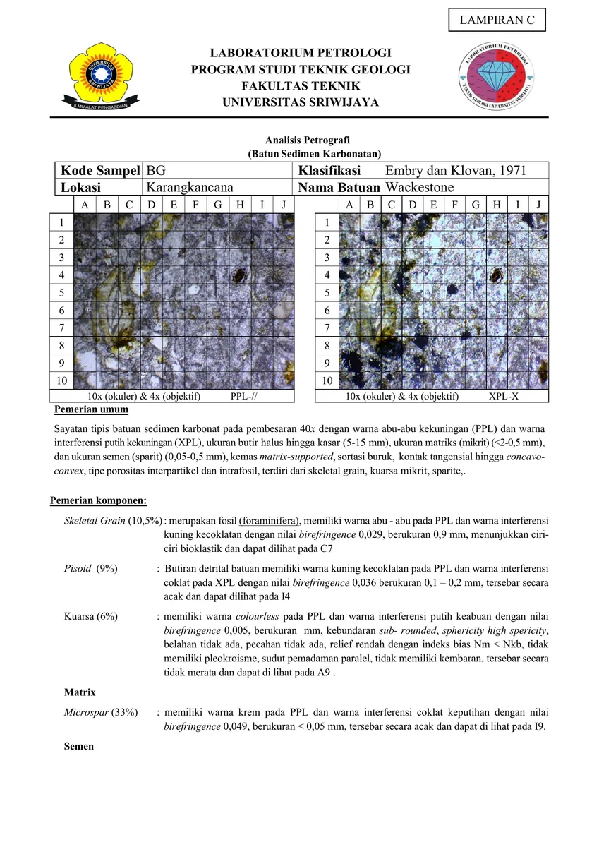
The final geological map and cross-sections are the highest-level synthesis of the survey, integrating 85 GPS-controlled stations across the 9 × 9 km area. Scientific credibility depends on cartographic completeness—CRS, scale, north, legend, contact certainty, structural symbols and section traces—and on internal consistency between every map and section relationship. Observed contacts should be distinguished from interpolated boundaries, and formations should not be ordered more precisely than fossil, petrographic and field evidence allow. The map is best evaluated by leave-one-out reasoning: ask whether the interpreted unit or structure would still be predicted if a key station were withheld. Zones with competing solutions deserve visible uncertainty rather than decorative precision.
- Source
- Private geological appendix archive · controlled source record
- Location in source
- Source-linked record
- Image quality
- HD
- Record ID
- appendix-08