Geological Mapping · mapping-4-2
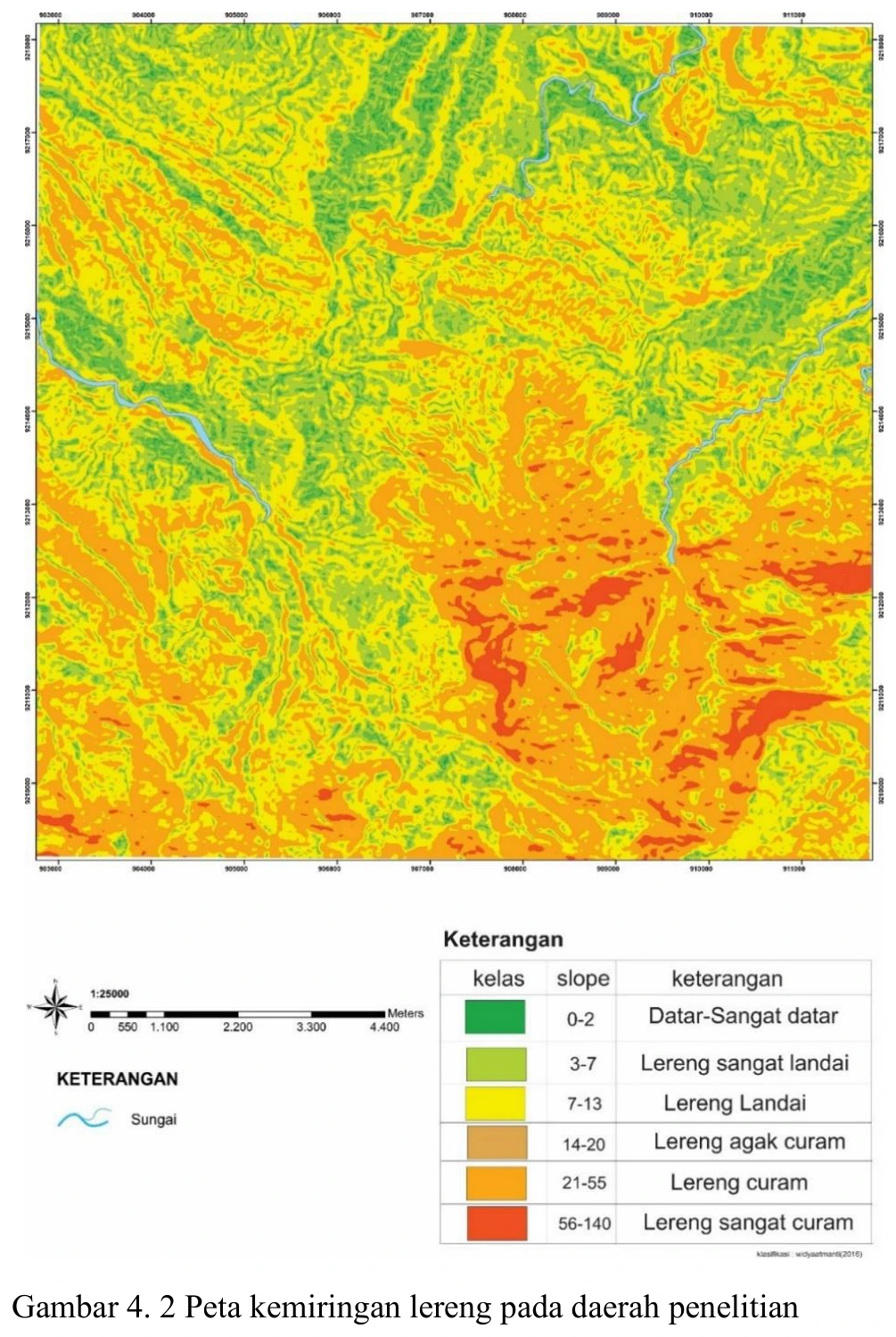
Slope-gradient map
The slope product converts topography into a process-sensitive surface that can support terrain segmentation, traverse planning and first-pass instability screening.
SOURCE-LED TECHNICAL READING
Geological interpretation and evidential boundary
The slope product converts topography into a process-sensitive surface that can support terrain segmentation, traverse planning and first-pass instability screening. A displayed maximum near 140% is plausible when slope is expressed as rise/run percentage, but would be impossible if read as degrees; the legend must therefore retain the unit and the calculation should state neighbourhood, cell size and whether percent or angular slope was used. High values are not landslide susceptibility by themselves because material strength, discontinuity orientation, drainage, vegetation, road cuts and rainfall are absent. The map becomes analytically powerful only when co-registered with lithology, structural domains, observed failures and exposure density, with uncertainty flagged where steep slopes coincide with sparse control.
- Source
- Private mapping source vault · geological evidence record
- Location in source
- PDF page 56
- Image quality
- Source scan
- Record ID
- mapping-4-2