Geological Mapping · mapping-4-22
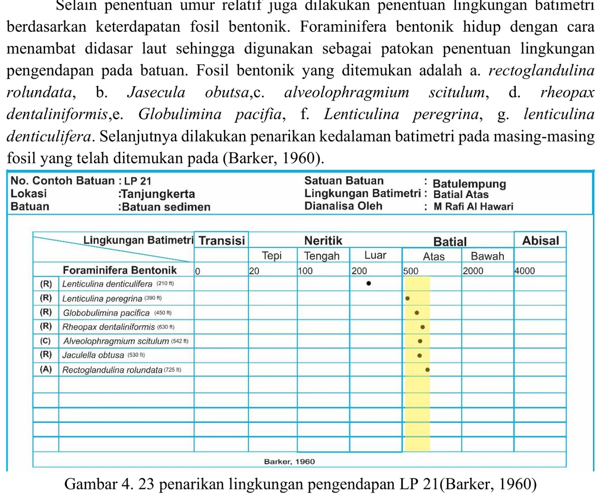
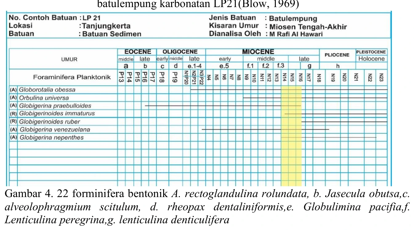
Benthic foraminiferal plate from LP21
The LP21 benthic plate is an assemblage-level environmental dataset, not a collection of independent depth markers. Relative abundance, diversity, wall composition, preservation and evidence of transport should accompany identifications.
SOURCE-LED TECHNICAL READING
Geological interpretation and evidential boundary
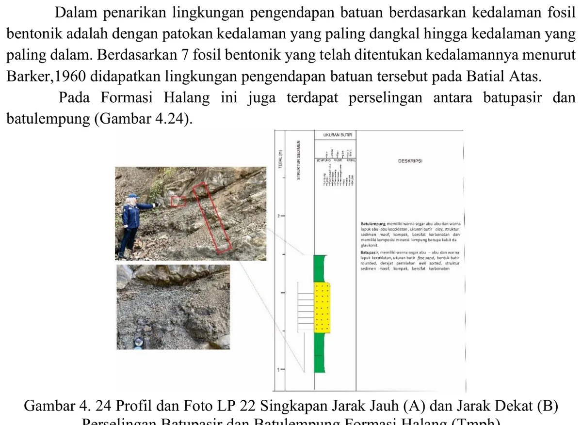
The LP21 benthic plate is an assemblage-level environmental dataset, not a collection of independent depth markers. Relative abundance, diversity, wall composition, preservation and evidence of transport should accompany identifications. Fine-grained host lithology may favour quieter-water deposition, but low-energy substrate, reduced oxygen or high organic flux can shift benthic composition independently of bathymetry. The environmental inference should therefore be framed as a probability distribution across shelf-to-bathyal settings, narrowed only where several ecologically coherent taxa dominate and sedimentological evidence agrees. A mixed population is geologically meaningful: it may record downslope transport or reworking within the Halang turbidite system rather than analytical failure.
- Source
- Private mapping source vault · geological evidence record
- Location in source
- PDF page 71
- Image quality
- Source scan
- Record ID
- mapping-4-22