Geological Mapping · mapping-4-28b
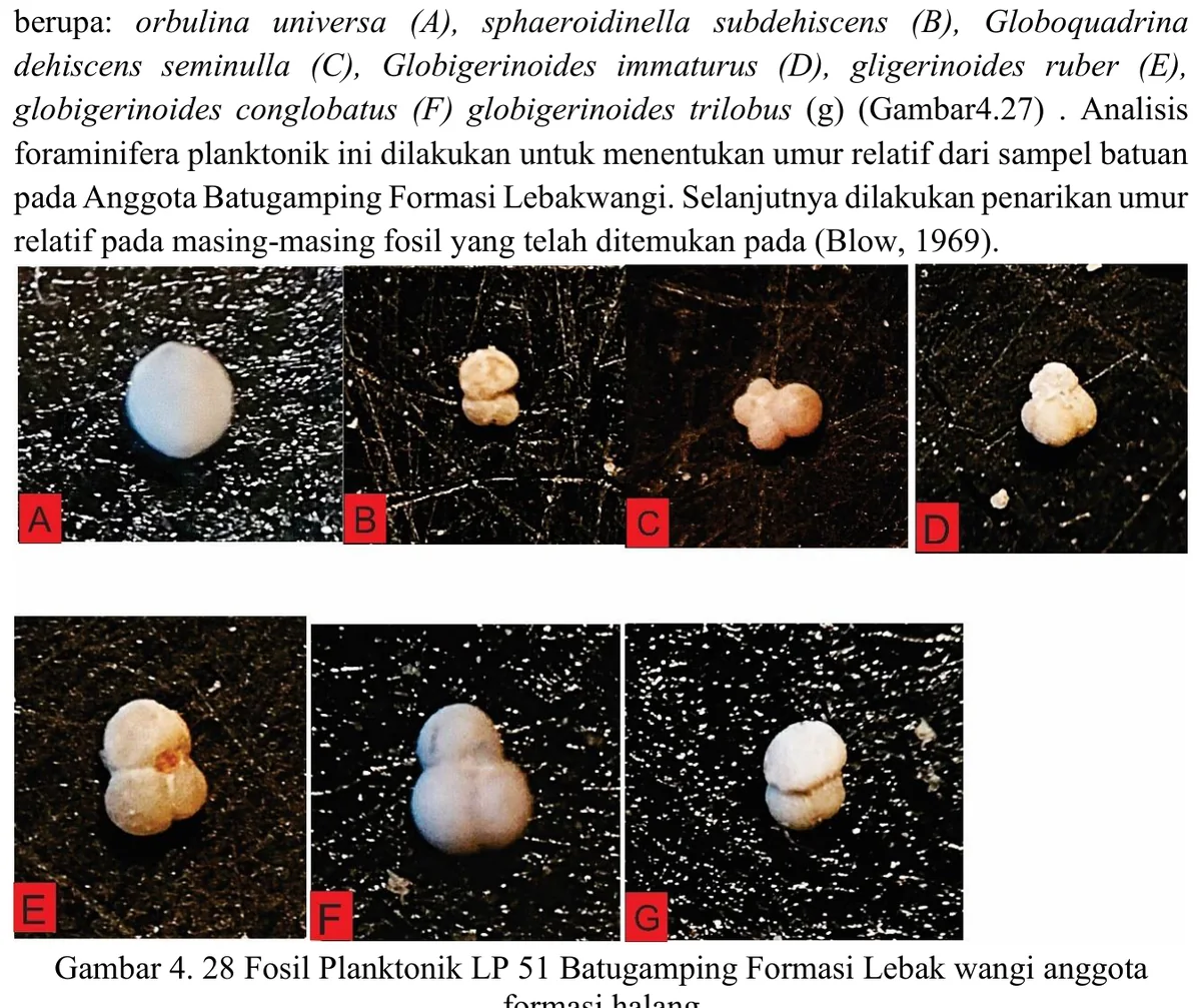
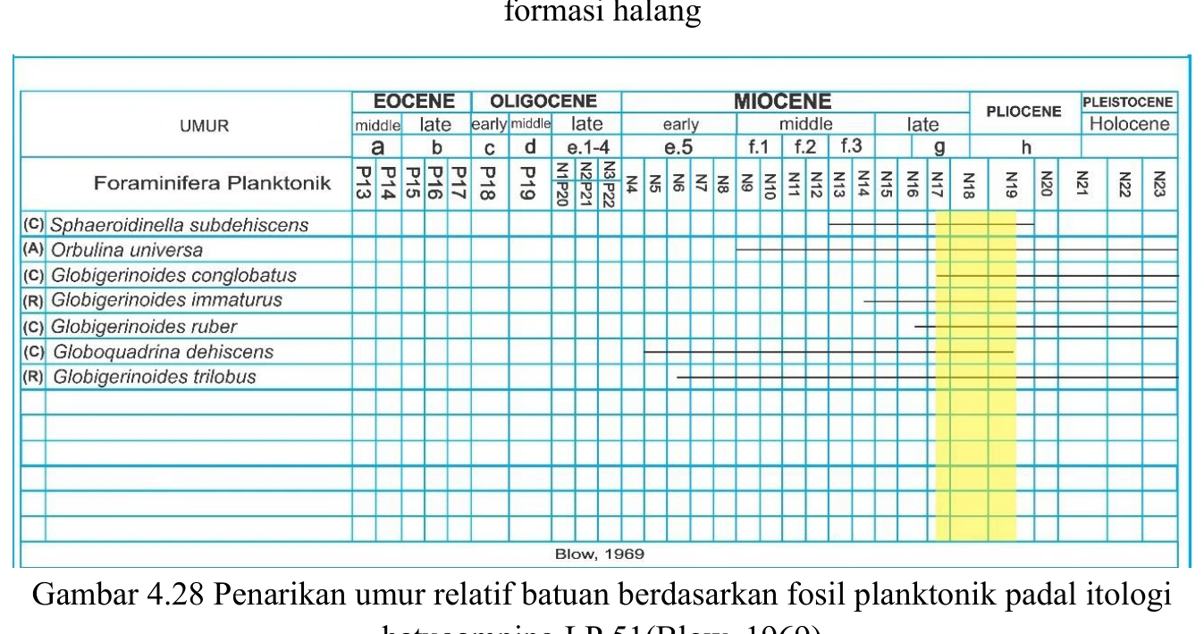
Planktonic range chart for LP51
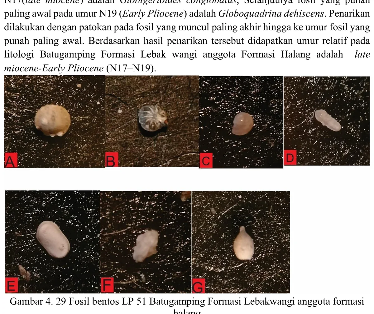
The LP51 range chart reportedly supports an N17–N19 or Late Miocene to Early Pliocene interval, but the precision and nomenclature must be tied to a named zonation and current taxonomic calibration. A broad three-zone range may be scientifically honest if diagnostic overlap is limited; compressing it to a single age would overstate resolution.
SOURCE-LED TECHNICAL READING
Geological interpretation and evidential boundary
The LP51 range chart reportedly supports an N17–N19 or Late Miocene to Early Pliocene interval, but the precision and nomenclature must be tied to a named zonation and current taxonomic calibration. A broad three-zone range may be scientifically honest if diagnostic overlap is limited; compressing it to a single age would overstate resolution. Each controlling taxon should be reviewed for preservation and reworking, and the resulting interval should be compared with regional map stratigraphy as an independent check rather than adjusted to match it. The chart’s best contribution is explicit uncertainty: it defines the chronological window that remains after fossil evidence, sample integrity and zonal assumptions are all considered.
- Source
- Private mapping source vault · geological evidence record
- Location in source
- PDF page 75
- Image quality
- Source scan
- Record ID
- mapping-4-28b