Geological Mapping · mapping-4-5
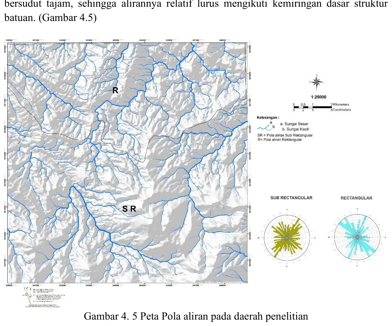
Drainage-pattern map
Drainage organisation records the integrated response of substrate, relief, runoff and geological discontinuities, so the map is best treated as convergent rather than diagnostic evidence.
SOURCE-LED TECHNICAL READING
Geological interpretation and evidential boundary
Drainage organisation records the integrated response of substrate, relief, runoff and geological discontinuities, so the map is best treated as convergent rather than diagnostic evidence. Repeated straight reaches, angular junctions or abrupt deflections may indicate fracture, bedding or fault control, but comparable patterns can arise from valley inheritance, resistant lithologic boundaries, gridding artefacts and road drainage. The structural hypothesis should be tested with orientation statistics that compare channel segments against independently measured bedding, joint and fault sets, ideally using length-weighted rose diagrams and a null distribution. Only lineaments corroborated by field kinematics, displaced contacts or damage-zone evidence should influence the final structural model; the remaining features should stay explicitly classified as geomorphic lineaments.
- Source
- Private mapping source vault · geological evidence record
- Location in source
- PDF page 60
- Image quality
- Standard
- Record ID
- mapping-4-5