Pit N Thesis · thesis-4-1
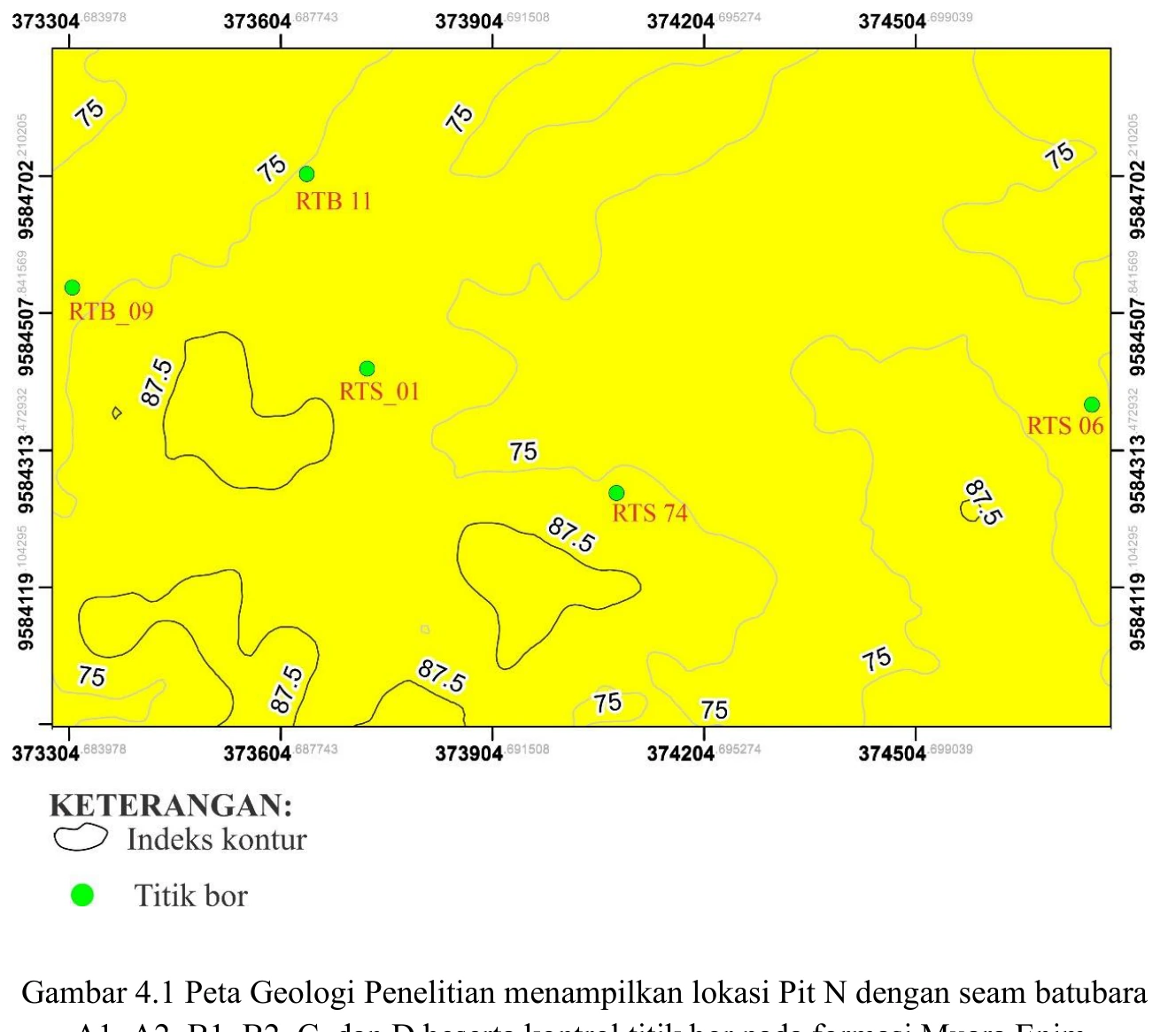
Research-area geological map and Pit N drillhole control
The geological map fixes the spatial problem before any facies or model interpretation begins: Pit N, mapped coal traces and the borehole collar distribution are shown in one reference frame. Boreholes constrain the subsurface only where they exist, so confidence should decrease away from collars and along extrapolated seam edges.
SOURCE-LED TECHNICAL READING
Geological interpretation and evidential boundary
The geological map fixes the spatial problem before any facies or model interpretation begins: Pit N, mapped coal traces and the borehole collar distribution are shown in one reference frame. Boreholes constrain the subsurface only where they exist, so confidence should decrease away from collars and along extrapolated seam edges. Map scale, coordinate reference system, collar elevation and the distinction between observed and inferred boundaries govern every downstream surface. The figure is therefore not a decorative locator; it is the uncertainty geometry for the entire thesis.
- Source
- Private thesis source vault · Chapter IV record
- Location in source
- PDF page 69
- Image quality
- Source scan
- Record ID
- thesis-4-1